


Voting District 30285, Placer County, California
About
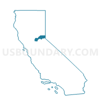
Outline

Summary
| Unique Area Identifier | 536664 |
| Name | Voting District 30285 |
| County | Placer County |
| State | California |
| Area (square miles) | 0.40 |
| Land Area (square miles) | 0.40 |
| Water Area (square miles) | 0.00 |
| % of Land Area | 100.00 |
| % of Water Area | 0.00 |
| Latitude of the Internal Point | 38.81813020 |
| Longtitude of the Internal Point | -121.22002050 |
Maps


Graphs
Select a template below for downloading or customizing gragh for Voting District 30285, Placer County, California


Neighbors
Neighoring Voting District (by Name) Neighboring Voting District on the Map
- Voting District 20105, Placer County, CA
- Voting District 20110, Placer County, CA
- Voting District 30025, Placer County, CA
- Voting District 30260, Placer County, CA
- Voting District 30265, Placer County, CA
- Voting District 30275, Placer County, CA
- Voting District 30280, Placer County, CA
- Voting District 30290, Placer County, CA